About Townsend’s Logbook Data
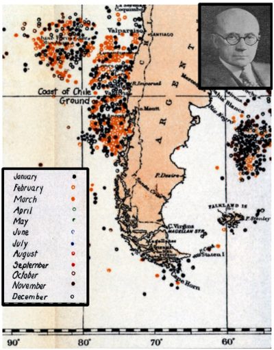
The data presented here are from Charles Haskins Townsend’s extractions from whaling logbooks. They include information on the location of whales based on a sample of logbooks from voyages made between 1784 and 19?? The data represent roughly half of those originally used by Townsend to create whaling charts.
Townsend extracted data on the location of whales from whaling logbooks, including vessel name, date, location, and species taken. His original data sheets were available to us for voyages by vessels with names beginning with the letters A through J. We digitized the available worksheets, and matched the voyages to our list of American whaling voyages through the Voyage IDs, their respective unique identification numbers in the voyages database. Townsend provided few clues as to how his source logbooks were selected but in his published account accompanying his maps, he included a comprehensive table showing vessels (listed alphabetically), voyage years, and catch by species for each voyage represented on his maps as well as lists of the institutional and individual owners of the logbooks.
Townsend CH (1935) The distribution of certain whales as shown by logbook records of American whaleships. 19. Zoologica (NY): : 1–50+6 Charts.